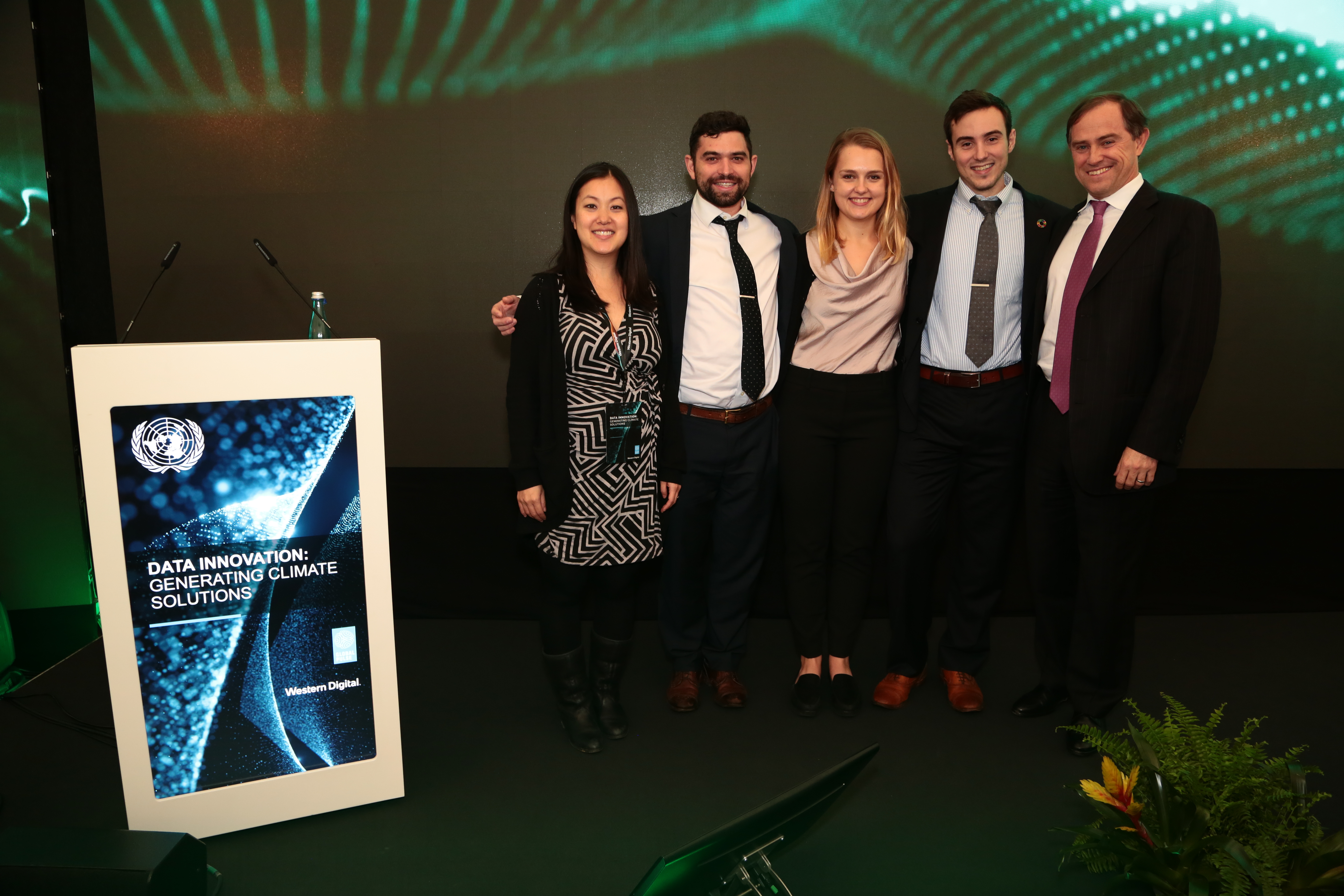
Meet the winning teams of the Data for Climate Action challenge and learn more about their projects.
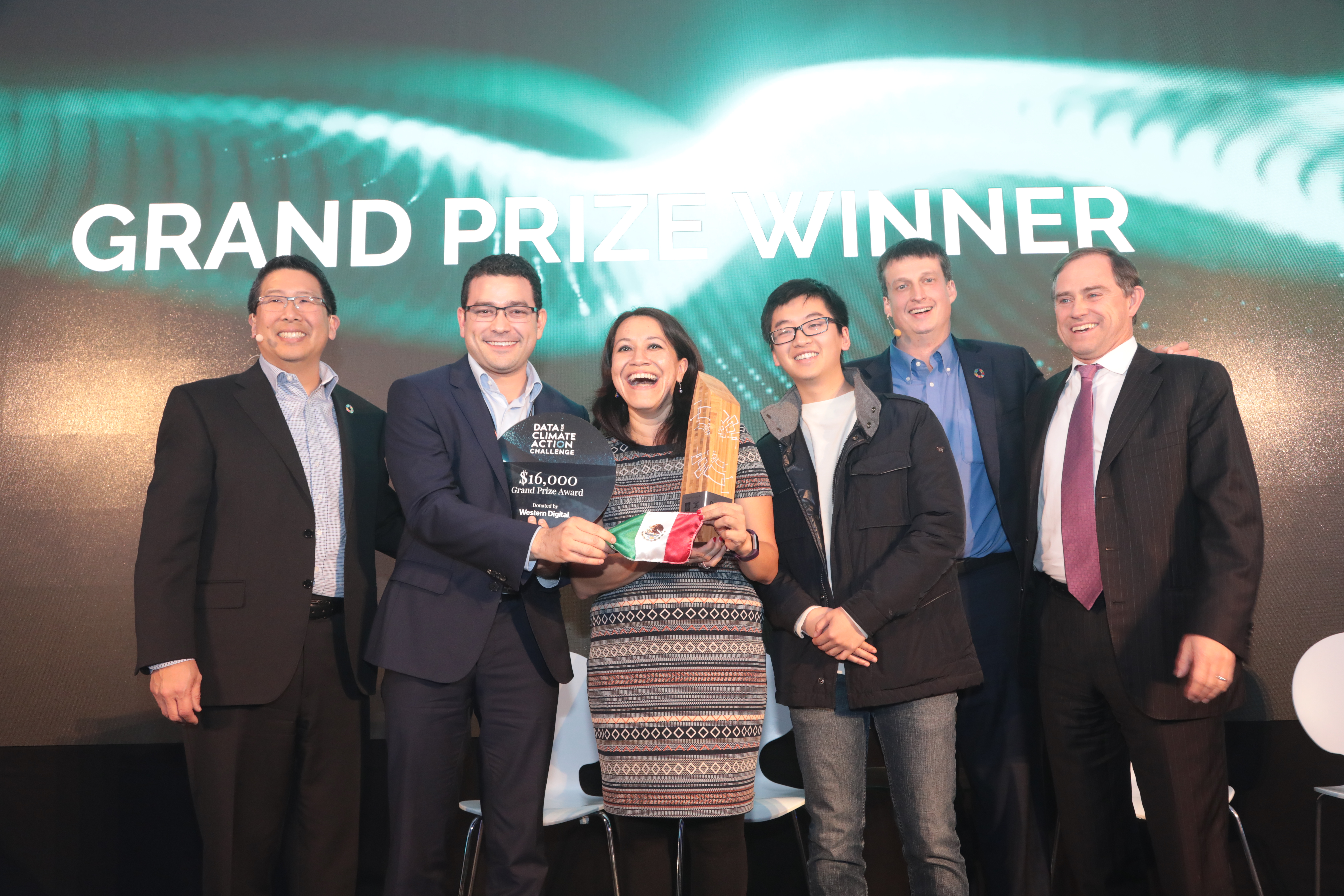
GRAND PRIZE WINNER
TITLE: “Electro-mobility: Cleaning Mexico City’s Air with Transformational Climate Policies Through Big Data Pattern Analysis in Traffic & Social Mobility”
AUTHORS:
[Instituto Nacional de Ecología y Cambio Climático]: Claudia Octaviano, Fabiola Ramirez, Oscar Araiza, Itzchel Nieto, Adolfo Contreras, Ulises Ruiz
[University of California, Berkeley]: Sergio Castellanos, Daniel Kammen, Apollo Jain, Pedro Sánchez, Alan Xu, Héctor Rincón, Alex Gao
THE PROBLEM: Mexico City is the most congested city in the world, and uses more than 20 million liters of fuel every day for transportation. In 2016, the local population was exposed to more than twice the levels of ozone and fine particulate matter (PM2.5) recommended by national air quality standards. It is estimated that meeting PM2.5 and ozone standards in Mexico City could avoid up to 10,856 deaths each year.
DATA SOURCES USED: Traffic data from Waze; data from EPA MOVES-Mexico, and Google Places’ Popular Times.
METHODOLOGY AND APPROACH: The team quantified the number of traffic jams at different times and locations throughout Mexico City, and then used the MOVES-Mexico model to estimate emissions from the transportation sector. The team also used data from Google’s ‘Popular Times’ to understand population movement patterns in Mexico City. Based on this information, the team evaluated different potential locations for electric vehicle charging stations, along with three different policies and their impact in terms of avoided emissions: (i) electrification of the entire taxi fleet in Mexico City; (ii) electrification of Mexico City’s public transit buses; (iii) electrification of all light-duty vehicles in Mexico City.
POTENTIAL IMPACT: The team found that policy (i) would reduce CO2 emissions from transportation by 3.4% and PM2.5 emissions by 3.1%; that policy (ii) would reduce CO2 emissions from transportation by 22% and PM2.5 by 24%; and that policy (iii) would reduce CO2 emissions from transportation by 49% and PM2.5 by 44%. The researchers identified strategic locations for EV charging stations in Mexico City, as well as two areas where electrification would be highly impactful both to serve highly populated areas and integrate marginalized communities: (a) along Circuito Interior and (b) the outer ring road Periférico.
CONTACT INFO:
Claudia Octaviano: claudia.octaviano@inecc.gob.mx
Sergio Castellanos: sergio.pvlab@gmail.com; sergioc@berkeley.edu
THEMATIC AWARD: CLIMATE ADAPTATION
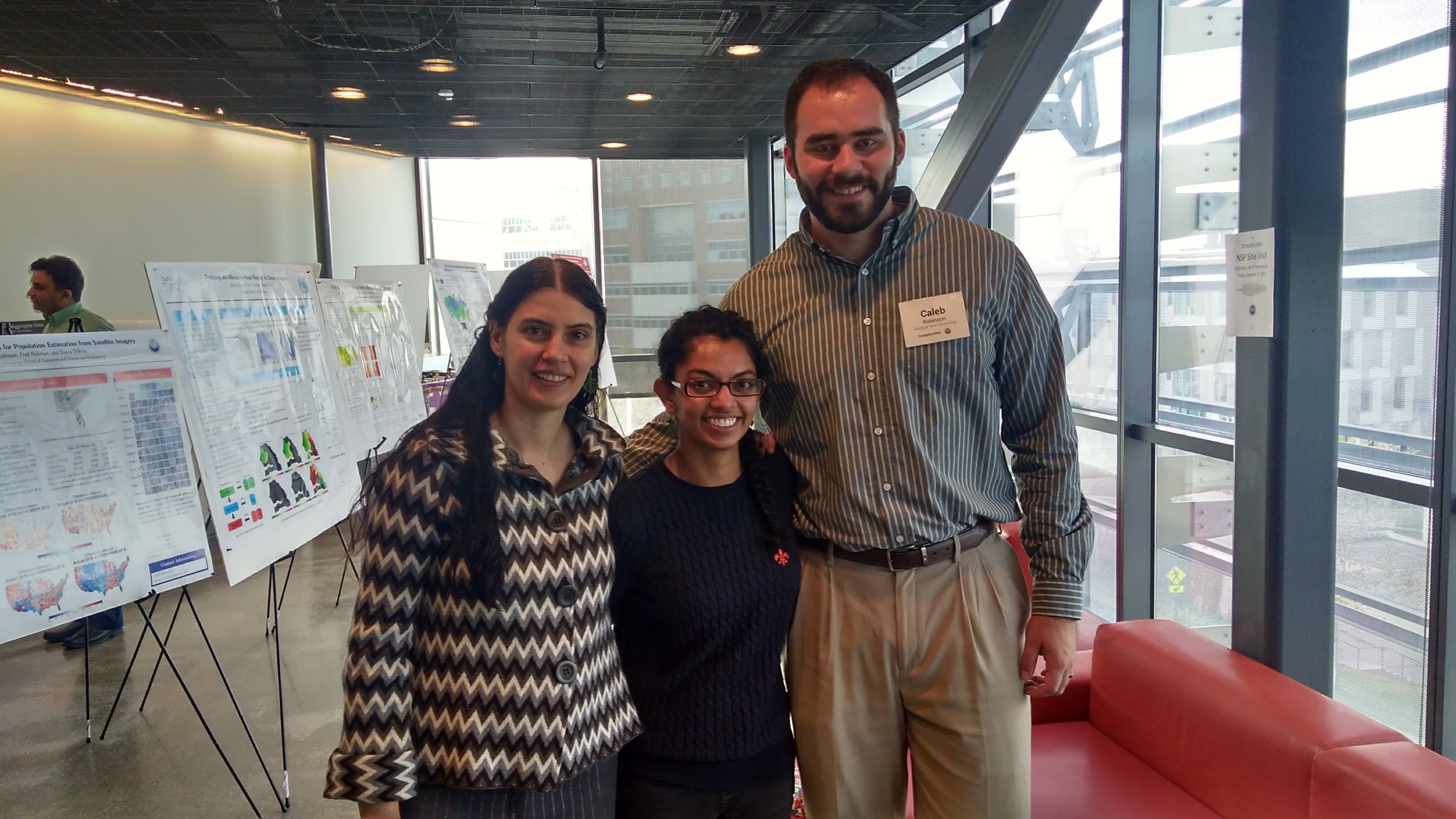
TITLE: “Predicting and Alleviating Road Flooding for Climate Mitigation”
Authors: Caleb Robinson (Georgia Institute of Technology), Amrita Gupta (Georgia Institute of Technology), Bistra Dilkina (Georgia Institute of Technology)
THE PROBLEM: Most of the road network in Africa is unpaved, so it is particularly susceptible to damage caused by rain and flooding. Global climate change is predicted to lead to more frequent and severe weather events, including more damaging floods.
DATA SOURCES USED: Data on flooding in Senegal from Fathom.global; mobility data for Senegal (derived from telecommunications data) from Orange S.A.
METHODOLOGY AND APPROACH: The team estimated flooding risk for different roads in Senegal, and then used mobility data to understand how much different roads are used. The team then built a framework to optimize the allocation of a certain budget to road upgrades: this framework indicates which upgrades should be prioritized in order to maximize the accessibility provided by the road network during floods.
POTENTIAL IMPACT: The framework developed by the team could be used in Senegal to optimize road upgrades and increase the resilience of the road network to flooding. The framework could also be modified for application in other countries.
CONTACT INFO:
Caleb Robinson: dcrobins@gatech.edu
Amrita Gupta: agupta375@gatech.edu
THEMATIC AWARD: CLIMATE MITIGATION
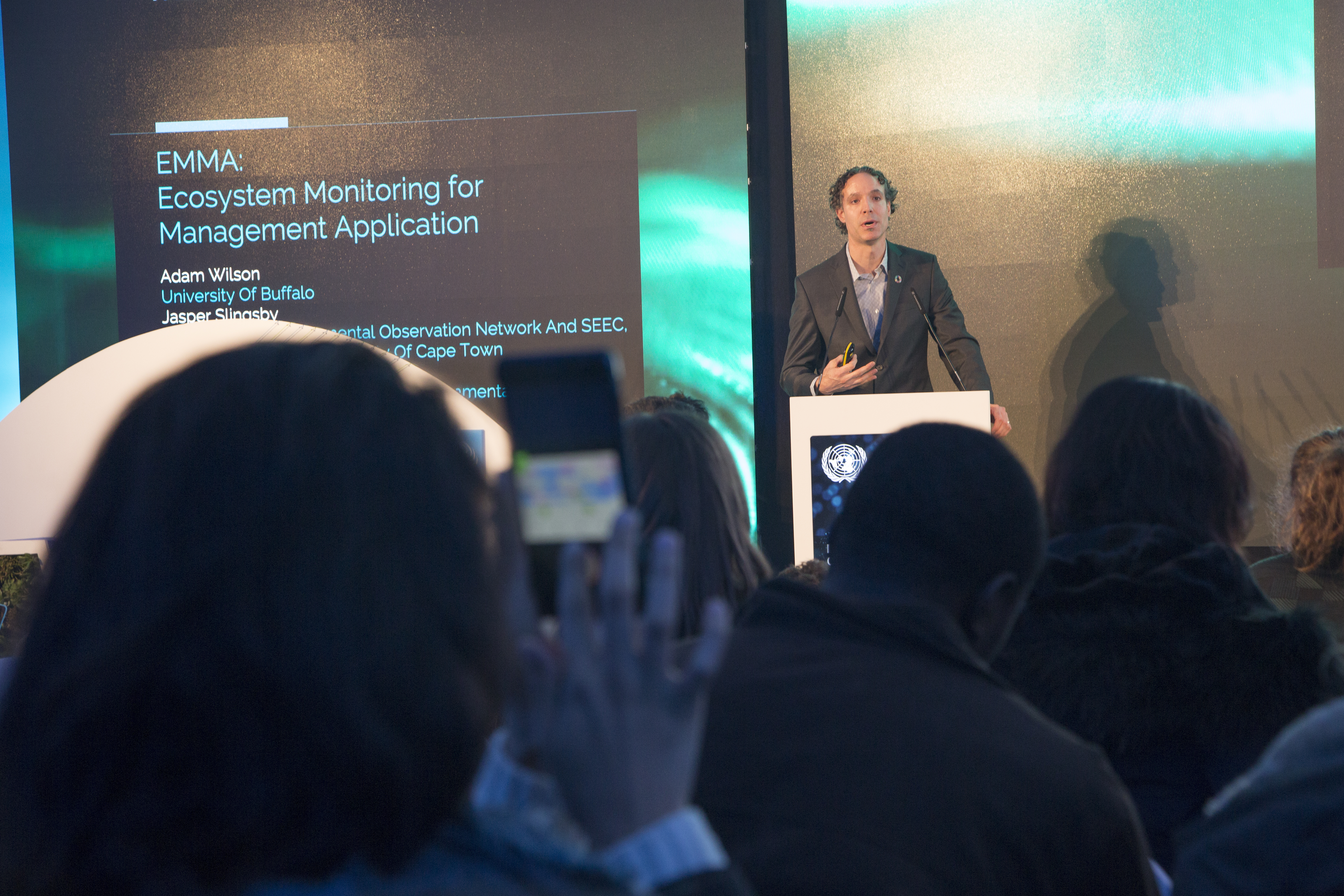
TITLE: “EMMA: Ecosystem Monitoring for Management Application”
AUTHORS: Jasper Slingsby (South African Environmental Observation Network and SEEC, Biological Sciences, University of Cape Town), Adam Wilson (University at Buffalo, Buffalo, NY), Glenn Moncrieff (Ixio Analytics and South African Environmental Observation Network)
THE PROBLEM: While a number of tools use real-time data (e.g., satellite imagery) to monitor changes in vegetation in forest ecosystems, few or no tools are designed to monitor these changes in non-forest ecosystems (such as shrublands, woodlands, and natural grasslands). The team set out to devise such a system for the Cape Floristic Region of South Africa, a hyperdiverse fire-prone shrubland and Global Biodiversity Hotspot. The region faces a number of threats, including habitat loss through land-use change, invasion by alien species and climate impacts.
DATA SOURCES USED: Satellite imagery from Planet; weather data from Schneider Electric; weather data from Earth Networks; social media data from Crimson Hexagon.
METHODOLOGY AND APPROACH: The team developed a statistical model for the regrowth of natural vegetation following wildfires using historical satellite imagery. The model was used to predict the expected recovery pattern of healthy vegetation based on time since fire, soil, topography and climate. These expectations were compared with recently acquired satellite imagery, and areas deviating from expectations for healthy vegetation were highlighted. The team then used hi-res satellite imagery and weather data to understand the cause of these disturbances. They built a demonstration web application as well as a smartphone application.
POTENTIAL IMPACT: EMMA could support more responsive and informed ecosystem management in the Cape Floristic Region. The tool could also be applied in other ecosystems with similar dynamics — such as the Californian chaparral, Australian kwongan, and parts of the Mediterranean basin — or modified for other non-forest ecosystems.
CONTACT INFO:
Jasper Slingsby: jasper@saeon.ac.za
Adam Wilson: adamw@buffalo.edu
Glenn Moncrieff: glennwithtwons@gmail.com
THEMATIC AWARD: CLIMATE & OTHER SDGS
TITLE: “Air Pollution Induced Micro-migrations: Impacts on Consumer Spending”
AUTHORS: John Brandt (Yale University), Angel Hsu (Yale University), Matt Moroney (Yale University), and Sophie Janaskie (Yale University)
THE PROBLEM: Air pollution can affect local economies when people opt to stay indoors and avoid restaurants, shops, and recreational spaces. With rising global temperatures, air pollution is expected to worsen due to shifts in temperature, humidity, wind patterns, and precipitation.
DATA SOURCES USED: Weather data from Earth Networks; BBVA credit card transaction data; daily air pollution data from the European Environment Agency (Airbase) for six air pollutants.
METHODOLOGY AND APPROACH: The team quantified changes in consumer spending and how these relate to shifts in daily average air pollution, as well as postal code, characteristics of pollution measurement stations, and day of the week.
POTENTIAL IMPACT: The team found that air pollution has clear impacts on consumer spending in Spain. The team’s results suggest that a 10% increase in air pollution in Spain for a year could lead to a loss of as much as 1.5% of Spain’s GDP. The results suggest that reducing fossil fuel consumption – and thereby reducing air pollution – could lead to significant economic as well as public health benefits.
CONTACT INFO:
John Brandt: john.brandt@yale.edu
Angel Hsu: angel.hsu@yale.edu
Matt Moroney: matthew.moroney@yale.edu
Sophie Janaskie: sophie.janaskie@yale.edu
Data Visualization Winners
WINNER #1
TITLE: “A Framework for the Optimization of Winter Wheat Seeding Date”
AUTHORS: Erdem Erikçi (Eriktronik Inc.), Alper Erdoğan (Eriktronik Inc.)
THE PROBLEM: Climate change is already impacting agricultural systems worldwide. Shifts in wheat production have implications for farming and food security around the world. Every year and geographic location has a particular best seeding date for wheat, which depends on various climatic factors. Early or late seeding is reflected in a yield penalty in the harvest.
DATA SOURCES USED: Weather data from Schneider Electric and Earth Networks; data from field trials of wheat varieties provided by iGrow (based at South Dakota State University).
METHODOLOGY AND APPROACH: The team built a model to determine the best seeding date for winter wheat for different locations in the northern hemisphere. They presented their results in two Tableau dashboards; one that visualizes geographic variation in best seeding date, and one that visualizes shifts in seeding date in certain regions over time.
POTENTIAL IMPACT: The proposed framework could help farmers manage seeding dates in the context of climate adaptation, providing critical decision support.
CONTACT INFO:
Erdem Erikçi: erdemerikci@eriktronik.com

WINNER #2
TITLE: “A Dynamic Spatial-Temporal Model of Urban Carbon Emissions to Drive Climate Action by Cities”
AUTHORS: Constantine Kontokosta, PhD (New York University), Yuan Lai (New York University), Bartosz Bonczak (New York University), Sokratis Papadopoulos (New York University), Boyeong Hong (New York University), Awais Malik (New York University) and Nicholas Johnson (New York University)
THE PROBLEM: The Paris Climate Agreement calls on the global community to limit global temperature rise to 1.5 degrees Celsius through significant reductions in carbon emissions. Cities are positioned to be significant actors in this process, as they can reduce emissions through improvements to building and transit efficiency, and face dramatic consequences of inaction through risks posed by sea level rise and extreme weather events.
DATA SOURCES USED: Weather data from Earth Networks; air pollution data from Plume Labs; traffic data from Waze; social media data from Crimson Hexagon; publicly available data from the City of New York, from the U.S. Census, and from the U.S. Department of Energy, among others.
METHODOLOGY AND APPROACH: The team developed a model and dashboard of hourly greenhouse gas emissions for each building and street segment in New York City. The methodology combines physical modeling and statistical learning and accounts for local variations in temperature and the urban heat island, building energy efficiency, building type and land use, traffic, street trees, population density, and household income. The team then compared the results from the model with air quality data and social sentiment data derived from Twitter activity to understand the environmental and psychological impacts of emissions.
POTENTIAL IMPACT: The tool developed by the team can provide city leaders and urban policymakers with a near real-time understanding of hyperlocal patterns of carbon emissions across their cities. The model and tool could also be adapted for other cities around the world.
CONTACT INFO:
Constantine Kontokosta: ck2218@nyu.edu
Urban Intelligence Lab: www.urbanintelligencelab.org